
Search a Manlius Street by Address
A street-by-street search begins with one precise address, not a broad name search. The property record can identify an assessed owner and parcel, while the map places that parcel in relation to the road. Recorded deeds then test the title trail. Election records and older address directories answer narrower, separate questions. Keep the source date with every result because an annual assessment roll, a deed recording, and a directory volume reflect different points in time.
- Enter the street number and name through Image Mate public access when the form permits it. Record the owner spelling, parcel or property identifier, situs address, tax mailing address, roll status, and the retrieval date.
- Open the same location in Onondaga County GIS. Use the parcel shape, road, adjoining outlines, and map context to confirm that the Image Mate result belongs to the intended Manlius address.
- Use the owner and legal description in Cott eSearch to find the recorded deed trail. The current owner is normally searched as grantee, then the prior grantor becomes the next title search.
- For election information, use the New York voter lookup only for an individual registered-voter confirmation with the required county, name, date of birth, and ZIP details. It is not a street browser.
- For an earlier household trail, consult a reverse or criss-cross directory at a library or archive. Capture the printed street spelling, number, household notation, and directory year before comparing nearby entries.
The sequence avoids a common error: treating the person named in one source as proof of every person at an address. It instead builds a dated path from location, to parcel, to title, and then to the limited records that may describe a historical occupant.
Manlius Street Directory in Image Mate
The county’s Image Mate public-access entry is the primary property-search route for an address, owner name, or parcel/property criterion when the public form permits it. The Town assessment page describes inventory, assessed value, exemption status, and related property information. It does not turn an assessed owner into proof of current occupancy.
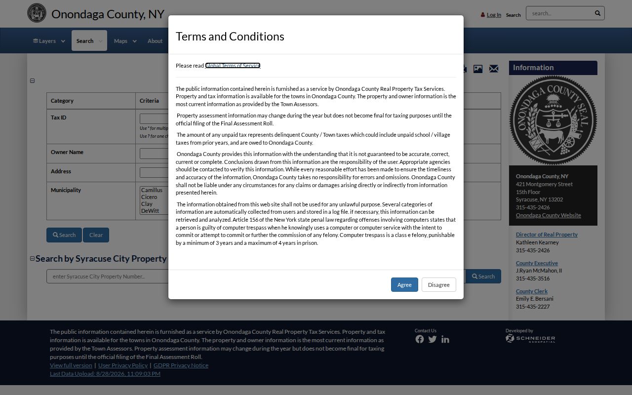
The entry screen is only the beginning. Use the public-access route, save the returned parcel details, and compare the assessment date with the final roll before relying on a name or address.
| Field label | Type | Required | Format or access note |
|---|---|---|---|
| Public Access / search entry | Link or button | Yes to search | Public access is the intended route; a login screen also exists. |
| Owner/name | Text | Optional | Exact format and partial-match rules were not located. |
| Property/situs address | Text | Optional | Use the exact number and street; field labels were not exposed. |
| Parcel/property identifier | Text | Optional | Exact format was not located. |
| Search criteria additions | Portal control | Optional | The notice advises starting with one item, then adding criteria. |
| Tax map / map image | Link or document | Optional | Image Mate notes that tax maps require Adobe. |
| Roll year/status | Selection or document | Optional | Tentative and final PDF rolls are available; exact selector was not exposed. |
| Search / reset / results | Buttons | Not stated | Exact labels and result limits were not located. |
Manlius Street Record Terms
The same address can appear under several different keys. Recording each key prevents a tax contact address or an old lot description from being mistaken for a current street location. These terms also make it easier to move from a map result to a title record without losing the connection.
- Parcel
- A defined piece of land used in assessment and map records. Its identifier helps distinguish similarly named owners and nearby addresses.
- Situs address
- The physical property address used to locate the parcel. It is different from the address where tax correspondence is sent.
- Legal description
- The deed’s lot, block, tract, or metes-and-bounds description. It can remain useful when street names or postal labels change.
- Criss-cross directory
- A reverse address directory that can place historical occupants or businesses at a printed street number for a particular year.
A tax mailing address may identify an owner’s correspondence location, a representative, or another contact point. Treat it as a lead for a second official search, not as a statement that the owner lives at the Manlius parcel.
Manlius Street Parcels in GIS
Onondaga County Planning GIS maintains the county’s spatial work and provides the public application at spatial.vhb.com. For a street directory search, the useful evidence is geographic: parcel shape, adjoining parcels, roads, and contextual map layers. It supports a check that the address and parcel are in the right place before a title or assessment name is carried forward.
The live viewer is dynamic. Research did not expose its exact layer list, identify label, parcel-to-owner handoff, or any measure, print, export, buffer, or radius controls. Do not assume that a visible boundary tool supplies a permanent export or an owner result. GIS geometry is not a deed and should never be used to infer a resident.
Manlius Address Records by Street
Address-keyed records are held by different custodians. The table separates a source that places or describes land from a source that documents recorded title, public work, election registration, or a past address entry. A parcel identifier and legal description are often the safest links between them.
| Record set | Custodian | Address evidence | Access |
|---|---|---|---|
| Assessment roll / Image Mate | Town Assessor and Onondaga RPTS | Assessed owner, inventory, value, exemptions, and tax mailing address | Public portal or PDF roll; confirm with the assessor |
| GIS parcel map | Onondaga County Planning GIS | Parcel shape, adjacency, road context, and map layers | Public dynamic viewer; exact controls are not documented in the capture |
| Deeds and mortgages | Onondaga County Clerk | Title parties, legal description, recording information, and mortgage terms | Cott guest index; images are paid or available through office/archive channels |
| Tract and subdivision maps | County Clerk Archives | Lot, block, tract, and historic map geometry | Archive or office access; fee and access can vary |
| Permits and code files | Town Code Enforcement | Permit, inspection, or complaint history at an address | Office or FOIL request; no public case index was located |
| Election records | New York and Onondaga Board of Elections | Individual registration confirmation through proper channels | Lookup requires county, name, date of birth, and ZIP; file requests have legal limits |
| Directories and census | Libraries, Archives, Census/NARA | Historical occupant or household context | Library, archive, or digital channels; years and coverage vary |
No single row supplies a street-wide household roster. The strongest result preserves the source, date, parcel key, and any unresolved conflict instead of blending names from records that answer different questions.
Manlius Assessment Roll Timing
Image Mate data is supplied by town assessors and may change until the final roll around July 1. The Town of Manlius sets taxable status and the exemption deadline on March 1, posts the tentative roll May 1, holds grievance day on the fourth Tuesday in May, and issues the final roll July 1. Preserve both the roll year and the date the result was retrieved.
Assessment evidence is administrative and annual. A current assessment owner may differ from the latest recorded deed because assessment updates and recording events occur on separate schedules. An exemption is also an assessment classification, not complete evidence that a particular person occupies the address.
Manlius Street Code Records
Town Code Enforcement handles permits for new construction, alterations, demolition, signs, and pools, along with inspections, complaints, notices, and code work. These records can place work at an address or date a change to a building. They do not provide a list of people associated with the property.
No public online case search was located. For a record not posted online, submit a reasonably described written request through the Town’s FOIL channel. Name the street address, record type, date range, and desired fields. The Town Clerk is the FOIL records-access officer, while building, planning, zoning, tax, and deed records remain with their respective custodians.
Manlius Street Title in Cott
The Onondaga County Clerk Cott eSearch entry provides a guest route for the deed index. Search a current owner as grantee and hold the legal description steady while moving backward through grantors and earlier grantee records. A street address alone may not match an older instrument, especially when the deed uses a subdivision lot, tract, or metes-and-bounds description.
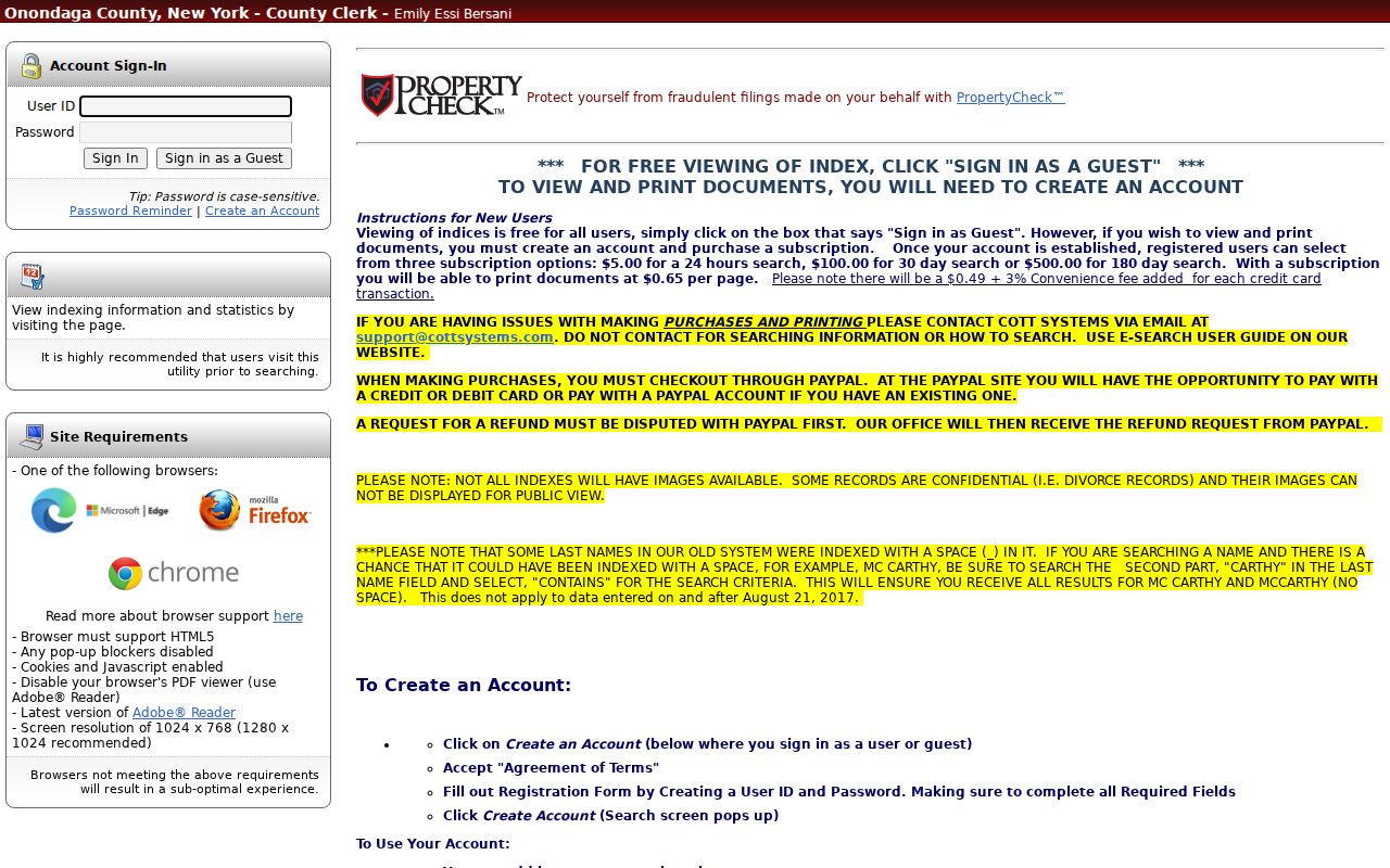
Guest index viewing is free, while image viewing and printing require an account and subscription. Some index records do not have images, and the exact online cutoff was not located in the official sources. County records begin in 1794, but that historical start date is not a promise that every deed is online. Save an instrument number, book/page, recording date, and image status so a County Clerk office or Archives visit can be focused.
A deed establishes title parties and the legal description. It does not establish who occupied a building or what physically stood on the land at a given time. Pair it with the dated assessment roll and, when appropriate, a directory or census source.
Manlius Street Postal Labels
A postal city is not the same thing as municipal jurisdiction. The Town of Manlius includes the villages of Fayetteville, Manlius, and Minoa, while addresses can carry different postal-city labels. Fayetteville’s 13066 service area extends beyond the village into the town and neighboring DeWitt. Keep the municipality, situs address, tax mailing address, and ZIP as separate fields.
Older records add another layer. The original 1794 Town of Manlius jurisdiction was larger than the present town, so a deed, directory, or census entry may use a parent-town or village label that does not match the current address. No verified local street-renumbering or street-renaming year was located, so no numbering history should be assumed.
Manlius Street Directory History
Reverse and criss-cross directories provide the historical address-to-occupant layer that assessment and deed records cannot supply. Search the printed street spelling and number, record the household notation and abbreviation key, then compare adjacent entries and the next or previous volume. An entry identifies what that volume printed for its year, not an undated household fact.
County Archives recommends using directories, tract maps, business certificates, and deeds together for historical property work. Syracuse-area directory holdings, local library material, and archive sources can help when an old Manlius address appears under Fayetteville, Syracuse, or a town label. The historical collection details are available through the Manlius city directories page.
Manlius Street Voter Limits
The New York voter lookup is an individual registration and poll-site route, not a public browse function for a road. Its captured search fields are county, last name, first name, date of birth, and ZIP, and the user must be a registered New York voter. A successful match is an election-use response, not proof that every person at an address is part of a household.
A voter-file request follows a different channel. New York requires an elections-purpose statement for a request, and public inspection is supervised with sensitive identifiers excluded under Election Law §3-220. Protected voters and Address Confidentiality Program participants require special handling. When a person needs verification rather than a street trail, use the separate Manlius resident lookup route and compare independently dated official records.
Privacy in a Manlius Street Directory
A parcel owner is not every person present at an address. Official property and election sources do not expose all household members, utility customers, delivery recipients, or protected addresses. DMV personal information is restricted by federal law, and New York’s Address Confidentiality Program requires agencies to use a substitute address for qualifying participants.
Lawful use. Use the minimum record needed for a personal, genealogical, or civic purpose. Public records never permit stalking, harassment, threats, surveillance, or repeated unwanted contact.
When records conflict, keep both sources and their dates, then ask the Assessor, County Clerk, Board of Elections, or other custodian about the appropriate correction process. A careful street record leaves uncertainty visible.